Community Patrols Document Illegal Logging, Fishing and Extraction in Internationally Recognized Wetlands Forest
As the government selectively defends only certain protected areas, Maya communities are organizing their own patrols to monitor their ancestral forests in southern Belize.
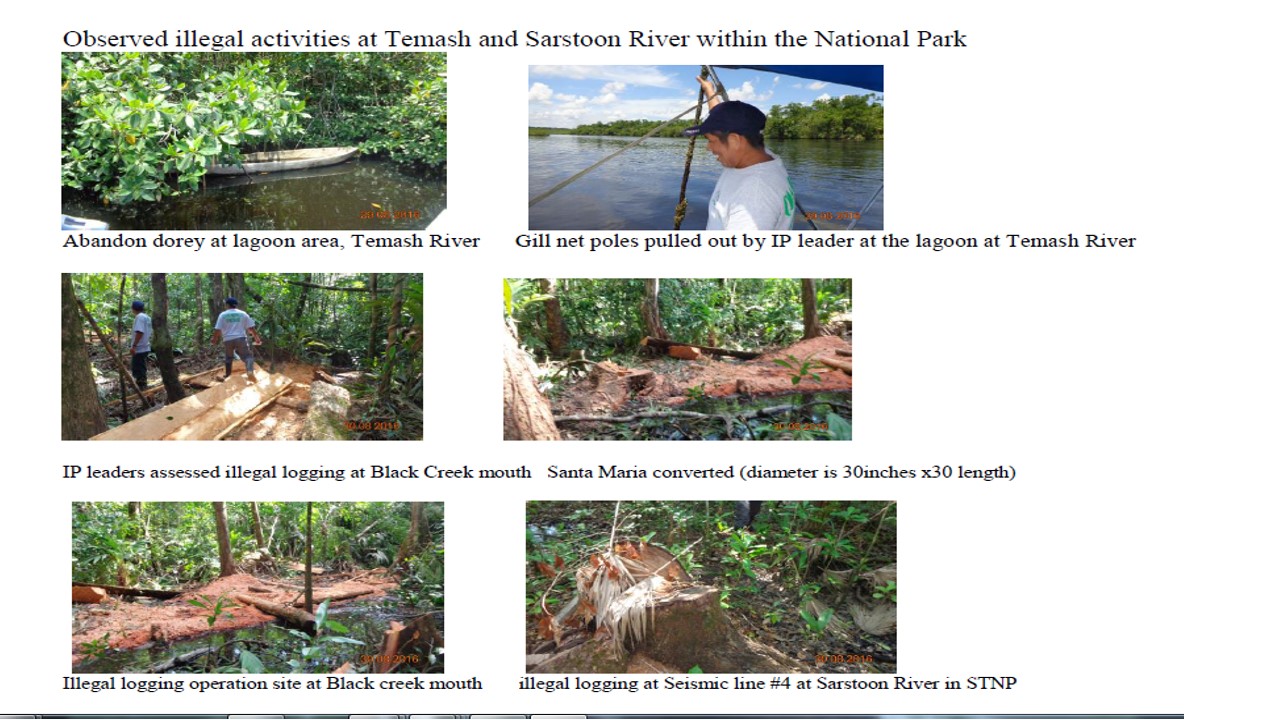
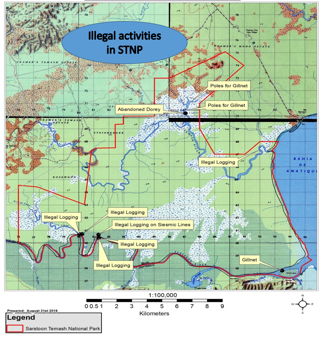
In August a SATIIM community forest patrol found evidence of logging along the Sarstoon River, harvesting of comfrey palms, and gill net fishing in the Temash River.
While the government announced efforts to curb illegal activity in the Chiquibul Forest in central Belize, it has ignored the Sarstoon Temash National Park in the district of Toledo in the south.
Almost 20 years ago, the government designated these Mayan ancestral lands a protected area — without community consent. Over the years Maya and Garifuna communities fought a long battle to first co-manage their ancestral lands contained in the park, and then to stop oil drilling in the government’s so-called ‘protected’ area.
In preparation for oil drilling, US Capital (the oil company contracted by the government) dynamited trails through this area recognized by the RAMSAR Convention on Wetlands. The paths were wide enough for jeep traffic. Soon the Maya communities saw evidence of the inevitable increase in poaching and illegal logging.
Since then SATIIM has organized community forest patrols to monitor environmental damage in the park.
The most recent patrol documented 50 seismic trails cut by from the mouth of Sarstoon River to Black Creek alone. Two trails showed recent activity in which Santa Maria trees were harvested and cut into lumber, ready for transport.
As always, the communities take responsibility as environmental stewards of their ancestral lands in the park. They shared their data with the government in the hope that one day it will assume its responsibility to defend — rather than destroy — the park it created.